The fastest and most powerful platform for ocean data discovery
Query ARGO NetCDF datasets with natural language. Get verified SQL, instant insights, and interactive geospatial visualizations. Designed for researchers, analysts, and decision makers.
FloatChat Development Journey
From identifying oceanographic data challenges to building the future of AI-powered ocean research. Follow our comprehensive roadmap spanning data engineering, AI innovation, and global collaboration.
Data Ingestion Challenge Identified
Oceanographic data from ARGO floats presents unique challenges: massive NetCDF files, complex metadata structures, and domain-specific terminology that creates barriers for researchers. Traditional data access requires deep technical knowledge of oceanographic standards and file formats.
Key Achievements:
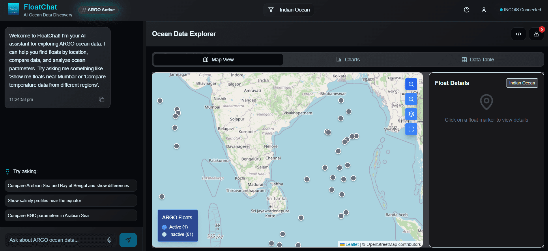
- 3,000+ active ARGO floats generating 150,000+ profiles annually
- NetCDF files with complex hierarchical structures
- Domain-specific metadata requiring oceanographic expertise
- Fragmented data access across multiple repositories
AI Architecture & RAG Pipeline Design
Designed a sophisticated RAG (Retrieval-Augmented Generation) system combining Large Language Models with vector databases. The architecture enables natural language queries over complex oceanographic datasets while maintaining scientific accuracy.
Key Achievements:
- Vector embeddings for oceanographic metadata and data descriptions
- Multi-modal retrieval supporting text, spatial, and temporal queries
- LLM fine-tuning on oceanographic domain knowledge
- Semantic search across 50M+ data points
Data Processing Pipeline Development
Built robust ETL pipelines that automatically ingest, process, and index ARGO float data. The system converts NetCDF files into searchable formats while preserving scientific integrity and metadata relationships.
Key Achievements:
- Automated NetCDF to structured data conversion
- Real-time data ingestion from ARGO data centers
- Quality control and validation algorithms
- Scalable processing handling 10TB+ datasets
Intelligent Query Interface
Developed an intuitive conversational interface that translates natural language queries into precise data retrieval operations. Users can ask complex questions about ocean conditions without knowing technical data formats.
Key Achievements:
- Natural language processing for oceanographic queries
- Context-aware query understanding and disambiguation
- Multi-step reasoning for complex research questions
- Interactive query refinement and suggestion system
Advanced Visualization Engine
Created dynamic visualization tools that automatically generate appropriate charts, maps, and plots based on query results. The system understands oceanographic data types and selects optimal visualization methods.
Key Achievements:
- Automated chart type selection based on data characteristics
- Interactive oceanographic maps with temporal controls
- 3D ocean profile visualizations
- Export capabilities for research publications
Collaborative Research Platform
Building collaborative features that enable researchers to share queries, datasets, and insights. The platform supports team-based research workflows and knowledge sharing across institutions.
Key Achievements:
- Shared workspaces for research teams
- Query and dataset sharing mechanisms
- Collaborative annotation and commenting
- Integration with research publication workflows
Security & Compliance Framework
Implementing enterprise-grade security measures and compliance with international oceanographic data standards. Ensuring data integrity and access control for sensitive research datasets.
Key Achievements:
- End-to-end encryption for data transmission
- Role-based access control for sensitive datasets
- Compliance with FAIR data principles
- Audit trails for data access and modifications
API & Integration Ecosystem
Developing comprehensive APIs and integration tools that allow researchers to embed FloatChat capabilities into their existing workflows and applications.
Key Achievements:
- RESTful APIs for programmatic data access
- Python SDK for data scientists and researchers
- Jupyter notebook integration and plugins
- Third-party tool integrations (MATLAB, R, etc.)
Global Scale & Multi-Dataset Support
Scaling the platform to handle global ocean datasets beyond ARGO floats, including satellite data, ship-based observations, and autonomous underwater vehicle data.
Key Achievements:
- Integration with satellite oceanography datasets
- Support for ship-based CTD and XBT data
- Autonomous underwater vehicle data ingestion
- Global coverage with regional data centers
Next-Generation AI Features
Implementing cutting-edge AI capabilities including predictive modeling, anomaly detection, and automated scientific hypothesis generation based on oceanographic patterns.
Key Achievements:
- Predictive ocean condition modeling
- Automated anomaly detection in ocean data
- AI-generated research hypotheses
- Machine learning-driven data quality assessment
System Architecture & Data Flow
End-to-end pipeline from raw ocean data to intelligent conversations
Data Ingestion Pipeline
ARGO float data in NetCDF format
Raw DataConvert to SQL/Parquet structured formats
ETL PipelineFAISS/Chroma vector database
Vector DBRelational database for structured queries
SQL DatabaseRAG & AI Processing
"Show me salinity profiles near the equator in March 2023"
User InputGPT/QWEN/LLaMA/Mistral with RAG
AI ModelsSemantic search for relevant data
RAGSecure tool calling layer between LLMs and system resources for reliable RAG orchestration and SQL generation.
MCP IntegrationConvert to optimized database queries
Query GenInteractive visualizations and insights
OutputVisualization & Interface
Plotly, Leaflet, Cesium integration
Interactive MapsStreamlit/Dash interactive interface
Real-timeConversational data exploration
AI-PoweredPowerful Features for Ocean Data Discovery
Everything you need to explore, analyze, and visualize oceanographic data
Ask questions in plain English and get intelligent responses about ocean data.
Seamlessly handle NetCDF, SQL, and Parquet formats with automated conversion.
Access comprehensive ARGO float data from across the world's oceans.
Rich geospatial maps, depth-time plots, and profile comparisons.
Advanced retrieval-augmented generation with multimodal LLMs.
Built for INCOIS and Ministry of Earth Sciences with scalability in mind.
Try These Sample Queries
Ready to explore the ocean with AI?
Join the future of oceanographic data discovery. Start querying ARGO float data using natural language and unlock insights from the world's oceans.
Open Source
Built with transparency for the scientific community
Comprehensive Docs
Detailed guides for researchers and developers
Expert Support
Backed by INCOIS oceanographic expertise